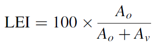
The Landscape Expansion Index (LEI) is proposed by Prof. Xiaoping Liu (Xiaoping et al., 2010), which is aim to give a deeper insight of landscape patterns and temporal dynamics. In addition to identifying the types of landscape expansion, LEI can also be used to describe the process of landscape pattern changes within two or more time points.
LEI is defined by using the buffer analysis, in short, the LEI for a new patch can be defined and calculated through examining the characteristics of its buffer zone:
where LEI is the landscape expansion index for a newly grown patch, Ao is the intersection between the buffer zone and the occupied category, Av is the intersection between the buffer zone and the vacant category.
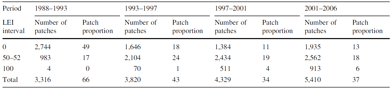
LEI have been applied to the measurement of the urban expansion of Dongguan in Guangdong province, China, for the period of 1988–2006. The analysis identifies three urban growth types, i.e., infilling, edge-expansion and outlying. A further analysis of different values of LEI in each period reveals a general temporal transition between phases of diffusion and coalescence in urban growth. This implies that the regularity in the spatiotemporal pattern of urban development in Dongguan, is consistent with the explanations according to urban development theories.
Stable distribution of three peaks in terms of the number of patches and the patch proportion for four periods
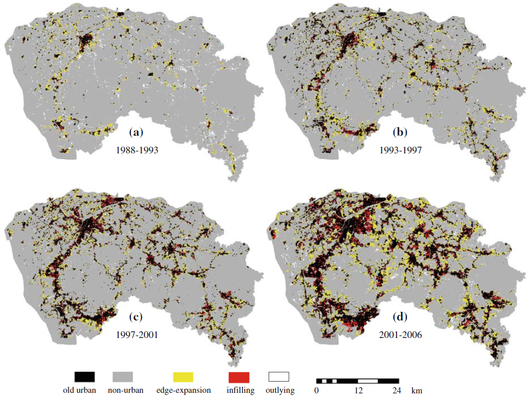
Spatial distribution of three urban growth types in the four periods
LEI and its variants can become an important tool for capturing the complex dynamics of urban growth by using multi-temporal remote sensing data. In contrast with conventional landscape indices which are capable of reflecting the spatial characteristics for only one single time point, LEI and its variants can capture the information of the formation processes of a landscape pattern. Being the supplement to the conventional landscape indices, the LEI and its variants are more capable of quantifying the spatial patterns of landscape expansion within two or more time points, and examine the way in which a landscape evolves, and reveal the relationships between the spatial distribution of a landscape as well as its evolution process.
A zip file which contains: LEI program can be installed as a tool in ArcGIS Desktop toolbox, sample data, user handbook, a demo viedo, also with the related paper is here:
All comments, questions and concerns should be directed to:
Liu Xiaoping
Professor,Geography and Planning School of Sun Yat-Sen University
135 West Xingang RD., Haizhu District
Guangzhou, P.R. China
Zip code: 510275
liuxp3@mail.sysu.edu.cn
Last updated: 1 June, 2016